Saturday, October 3, 2009
V-Con (No, Really!)
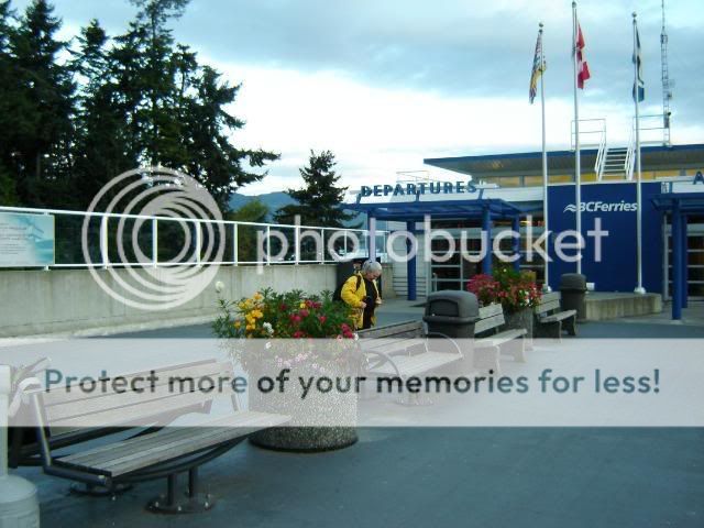
20 Minutes to down-town and another 40 or so out to the ferry with a 5 minute transfer layover, that's not bad. Sure, we ended up at the ferry an hour earlier than we needed to, but that was my fault rather than a flaw in the transit system.
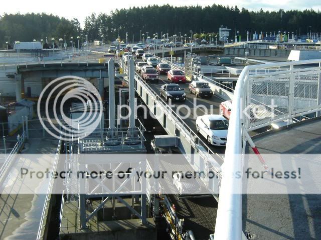
Traveling as a walk-on is really a good way to use the ferry; it's so much more relaxed than worrying if your car is going to start, and making sure to park close enough and all the rest of what we think of as normal at the terminal and on the ferry.
Notice that there's two layers of traffic loading. That's a lot of cars, and this isn't one of the new "Super-C's."
Passengers, on the other hand, have a much quieter boarding experience.
Although there are a lot more passengers than 20 years ago. Paula and I have boarded, gone up a deck, found kiosks to sit at (so that I could plug in the Aspire 1ne), and dropped our packs, and there are still walk-ons loading.
Once at the other end of the ferry route, we waited maybe 10 minutes to board a municipal bus. Okay, 5 bucks, but that got us right into down-town Vancouver.
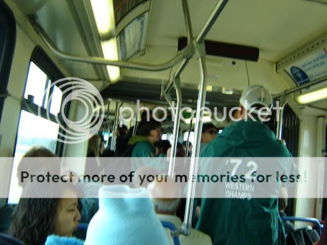
This was one of the articulated buses we're familiar with from our days in Edmonton, but haven't ridden out here. Victoria went with the even cooler, retro-styled double deckers rather than the articulated buses. A good choice, I think.
The double-decker buses (you can see one at the front of the queue here) are air-conditioned and quite comfortable. Besides, riding up top offers a hell of a good view, even if the ride itself can be a bit rocky on occasion.
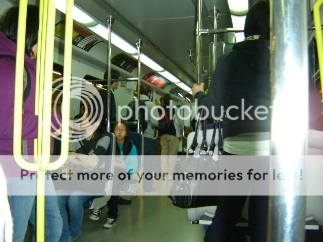
The Skytrain, on the other hand, especially the new Canada Line, is a terrific ride. And the new cars are a delight. Notice the vertical bar on the right, with the four loops sticking out of it--making a terrific number of handholds when the car is full.
Our trip in from the ferry took about an hour all told. We boarded the bus about 10:00 am and were checking in to the hotel just after 12:00.
It is strange to be at a V-Con again after so many years away. It didn't take long before I was having fanzines thrust into my hands; an old BCSFAzine, and a copy of Why You Got This Zine #5. It took me about ten minutes to realize that we'd published the original WYGTZ and we'd done it back in 1983 (all nicely credited in the extended colophon). Kathleen is now pubbing her ish, and doing a lovely job of it--making sure that its only available in print and not online, which is unusual and quite nice.
And after decades:
Garth! It was great to see Garth again and catch up on at least an overview of the last few years.
There were other people, of course. People I live near:
like Karl, busy minding the Neo-Opsis table.
And Stephanie, gettinga few minutes away from the table.
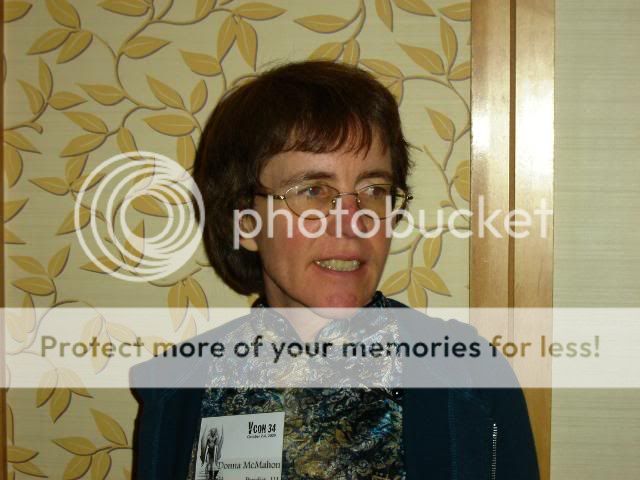
But there's also Donna and Clint
who seem to becoming regular features in this life. Which is interesting and unexpected.
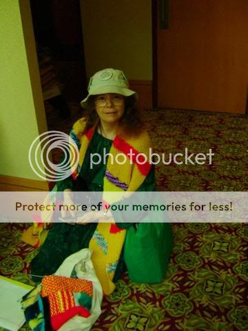
Marlene happened to be in Van and so she showed up--and got the chance to play dress up in the dealer's room. The period / pirate clothing was a real treat; the women looked lovely and the men looked dashing, and I even gave it a go. Ah, to be independently wealthy, and have a place to wear pirate clothes...!
SF Canada threw a author party / book-launch Friday night
Which was neat and well-attended. The idea was to create various circles of chairs and then scatter author names about, so that people could either sit beside authors they knew, or figure out who it was they were sitting beside.
There was also a book table--these are, after all, authors.
The event was well attended. Just a few of the familiar faces:
Brian Hades
Barry Alder
Selu--whom we had met on the Skytrain, having completely missed her on the ferry and bus....
Paula, having a good time chatting.
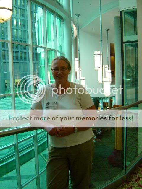
And Fran. Overall, quite a different Friday for me.
Monday, July 13, 2009
Kayaking in Sidney
Thursday, July 9, 2009
Juan de Fuca Trail Day Four 12 June 2009
Woke up about 5:00 am, after a night of short sleeps, broken by waking up to roll over or pull more sleeping bag over me. So I had a quick breakfast of a Rebar© and Advil© washed down with the last of my water.
I was on the trail by 6:00 am, heading for Botanical Beach and Port Renfrew. The trail was good; few climbs, and lots of elevated boardwalks to keep feet out of easily-damaged areas. The last 7 km was a lot closer to an exhausted march than I would have liked. Interrupted sleep means I wasn't bouncing back as well as I had hoped. My legs were tired but willing, but my feet wasted no time in hurting. I had moleskin on all my blisters and hot spots, but my feet just hurt. It was the old brain that was the most tired, though. I was moving along at my pretty-standard kilometre every 25 minutes or so, but it was taking a lot more concentration to remember to do things like lift my feet all the way over an obstruction. Even so, I was off the trail at the Botanical Beach trail head at 9:00 am.
From the trail head, it was about another three kilometres into Port Renfrew along the paved road. I found the hotel where I was to catch the bus back to Victoria the next day. When I called to see if there was space on the Friday bus, I found out that daily service didn't start until the following Monday, so I was stuck in Renfrew for the night.
Main Street, Port Renfrew 2009
But first things first. Port Renfrew is only about 150 families in size, and mostly strung out over a couple of kilometres long strip, with not a whole lot of width to the town. So it wasn't hard to find anyplace, and I quickly found the Coastal Kitchen Café. The only real restaurant in town, its open early and serves big portions. I ended up eating there twice, breakfast both Friday and Saturday mornings. My Friday celebratory breakfast tasted great; a big load of French toast and my first cup of coffee in a month. The restaurant uses thrift-store mugs, and sitting amongst the ones to chose from was my mug. A large (two-cup) ceramic blue-and-white spackleware mug, I bought this mug back about the time the kids were first born. It was the mug I used for years on the farm—I even made a spruce cap for it so I wouldn't get sawdust in it while I was working in the shop. I think it eventually broke, but here it was, sitting on a tray in a café in Pt. Renfrew. The owner actually offered to give it to me, but after so many years, I figured it was time for someone else to own it. But is was nice to see it again.
After breakfast, I ended up walking through town and found a place that actually caters to hikers—a laundromat and (more importantly) a coin-operated shower! The general store sold me a single razor and five bucks later I felt (and looked) more civilized than I had in days.
Friday morning in Port Renfrew, 2009
I ended up getting a hotel room for the night—ever been in a place where you weren't even tempted to take the travel shampoo? Well, that was the West Coast Trail Motel. Rooms weren't bad, but I had to clean the filthy coffee maker before it could be used, and the shampoo was in little tear-open pouches. The minute your hands are wet, you can't possibly open them, so you use your teeth with the risk of having shampoo breath afterwards. And seriously, who puts two copies of the same art print in a room? You can't get two different prints for the same price? From a customer service point of view, shouldn't you tell guests that “the satellite is down and there's only one channel” at check-in? Honestly, the room was way over-priced. However, the bed was nice.
Saturday was spent drinking tea and reading second-hand novels from the rec centre—run by an amazing woman. Breakfast was again at the Coastal Kitchen Café—the “fisherman's breakfast.” This was three eggs (not local, not fresh, not free-range), “the best sausage on the Island”(not local, not fresh, almost cold, and certainly not “the Island's best”), hash-browns (very hot potato-based food-like substance), toast (thick slices, but of a mediocre bread) and the whole works cost me $8. Man, sure let me know what I have been taking for granted.
Ocean spray, Pt. Renfrew 2009
The West Coast Trail Express bus picked us (myself and the other three hikers) at one end of Pt. Renfrew and then drove through town, picking up a dozen or more people fresh off the West Coast Trail and hauled us all back to Victoria. The bus had a sign up saying “for your comfort, this vehicle is equipped with air-ride suspension.” I figure that means that for most of the ride, you're suspended in the air. But the Express is a great service, running hikers and gear from Victoria to pretty much any point along the West Coast between Sooke and the north end of the West Coast Trail. It is exactly the right scale for the job, and serves the community well.
Eventually, I made it back to Victoria, and bused home on the municipal service. Happy to have been gone, happy to have successfully hiked the JdF, and happy to be back home.
Powered by ScribeFire.
Tuesday, July 7, 2009
Juan de Fuca Trail Day Three 11 June 2009
Chin Beach to Sombrio Beach, that was the plan. After last September and taking four hours to make the 6 km hike (leaving me utterly exhausted), I thought that planning Chin to Sombrio as my hike for the day would be about right. I even planned for a rest stop after climbing out of Loss Creek (which I believe is the most vertical metres of the entire trip). But things didn't go as planned.
Instead, the entire hike from Chin to Sombrio, beach to beach, took 2 ½ hours. And then I stopped for breakfast . Heart, lungs and legs were working in perfect harmony—I have no explanation as to why. But the climbs and descents were nothing like ten months ago. I pulled in to the campground at Sombrio and made some oatmeal, and as I was eating it, a group of six hikers was just leaving Sombrio for Kuitshe or Payzant campsites. I cleaned up my utensils, abandoned a water bottle (not on purpose) and decided to set out to Kuitshe about an hour after them.
Eagle on Sombrio Beach 11 June 2009
The trail is not solely in the bush—quite often it leaves the bush and traverses the beach. Meaning that if you don't pay attention to the tides, you can get stranded or find the beach impassable for a couple of hours. This sounds like a big deal, but it really isn't. Tide tables are posted at each beach, and you can time your hike around the tides. What is difficult is finding the place where you exit from the beach and head back along the trail. These points are supposed to be marked with large orange or red float balls hung in the trees. But time, sunshine and weather have destroyed some of the balls. Others are small and branches have grown in such a way as to screen them. Finding your way on to the trail is often an adventure in itself.
The rest of the hike, from Sombrio beach all the way though to the end at Botanical Beach, is rated as moderate. The elevations are lower and the transits along the same elevation are longer. The trail itself is about the same, with water working its way downslope finding the trail and turning it to mud. Or, in some cases, the water decides the trail makes a good stream bed and flows along it for five or ten metres before returning into the loam.
Fern unfurling along trail to Kuitshe 11 June 2009
The beaches were covered with sand fleas by the thousands—little springtails that would cluster on bits of seaweed. As I walked by, they would leap wildly, this little fountain of bodies going every which way. Or crabs in the intertidal zone; left with the tide pools, rocks or washed-up clumps of seaweed to hide under, there were thousands of them as well, all between 10 and 30 millimetres across. Those that could, scurried under rocks or seaweed as I passed. Those that had nowhere to go, backed up, flashing white-edged claws at me, warning me not to come any closer. Of course, while their claws were only a millimetre or two long, this wasn't much of a threat, but they did the best they could with what they had.
salmonberry blossoms
There were other discoveries along the trail as well; apparently slugs like orange peel. And they like it a lot. The peel I saw hadn't had time to dry and shrivel, yet there were several holes the size of toonies in it and a couple of slugs still working it over. And both ants and millipedes like dead slug (I knew something had to, but had no idea what did).
My plan had been to stop at Kuitshe—well, that had been my plan after storming the hike from Chin to Sombrio. But I got to Kuitshe and found that it was still early, I was still feeling strong, and there really wasn't any reason to stop, so I carried on. I ended up at Payzant campsite, about 13 km further along than I had expected to be—and only 7 km from the end of the trail at Botanical Beach. There had been quite a few people on the trail, enough that I was surprised by how busy it was. This was, after all, mid-week in early June. But like Chin Beach, Payzant filled up as the evening wore on. I arrived about 4:00 pm and the first four of the party of six I'd met at Sombrio came in about 4:30 pm. The last two didn't make it until 6:15 pm—late enough that their mates were starting to get worried.
So after all, it was a 19 km day. A great day physically, and a personal best. I was beat, at the end of it, but just tired, not feeling destroyed. Dinner and sleep would serve to restore my strength and, even more importantly, replenish my sugar stores so that I could do it again tomorrow.
Powered by ScribeFire.
Monday, July 6, 2009
Saturday, July 4, 2009
Juan de Fuca Trail Day Two 10 June 2009
This was the day of the hike I had been dreading the most; Bear Beach to Chin Beach. A little over 10 km long, it is rated as “very difficult.” Last September I hiked from Sombrio Beach in to Chin, a distance of 6 km and rated as “difficult,” a hike that had radically changed my perceptions of the JdF and my own fitness levels.
Chin Beach 2009
When I hiked from Sombrio to Chin, I had expected a challenge, but nothing like what I was confronted with. The first kilometre out of Sombrio is brutal, and by the time I made it to the old logging road at the high point of the trail, I'd climbed about 160 metres—much of it more than once. By the time I got to Chin Beach four hours later, I had used up all my energy reserves, and I ended up setting up camp and then sleeping for a couple of hours, quite exhausted from the hike. The next day I was facing either going back the way I'd come (no thank you!) or continuing into a section of trail I didn't know, but that was twice as long and rated as even more difficult. I ended up pulling the pin the next morning, hiking out to the highway some 200 metres above me ( a heavy climb, but the least objectionable alternative at the time).
Over the winter, I was certain that I wanted to hike the JdF, but that rating, “very difficult,” kept raising its head. The 10 km kept growing in difficulty in my head, getting longer, higher, and more wild. I thought about it, and the more I thought about it, the worse it got. So facing it on my second day out, well, I was not happy. In fact, I was very nervous.
When planning the hike, I had set aside 6-8 hours for this section of the trail. My thinking was to hike to the halfway point (or better, if I was lucky/strong enough) and then break for a good lunch and maybe a short nap before taking on the second half. I was looking forward to having finished this section, but I wasn't looking forward to doing the actual hiking. I ate breakfast, refilled my water bottles, and was on the trail just after 8:00 am.—and was on the beach at Chin at 12:30pm.
It's not that the hike wasn't hard, it was. It just wasn't brutal, and nowhere near as hard as I'd built it up to be in my mind. Going back over the map, I see that the trail never gets more than about 100 metres above the beach—only two-thirds the maximum height on the Chin to Sombrio section. I can't really figure out why it's rated as “very difficult,” except that its twice as long as the Chin-Sombrio section.
Beautiful, though. Some points look down on some lovely looking beaches, although there is no land access to them. My timing was apparently off, though. The couple who left 10 minutes behind me kept seeing Grey whales at the lookout points, while I only saw one seal lazing about while hunting the near-shore. The couple figured it was the same whales, moving down the coastline at about the same speed that they were. Mostly I was seeing the slugs, spiders and millipedes along the trail.
Slugs on the end of a log
This actually makes sense; I was more focused on the microcosm rather than the macrocosm (well, maybe not the micro-, but at least the “small-cosm”), just as the outward journey of the hike was reflecting the more inner-directed journey I was on. There was a tremendous amount of inner monologue going on in my head, liberated by the physical demands of the hike. It was very difficult to achieve the state of inner silence, of “just being” while hiking.
I also spotted a couple of red squirrels along the trail. At first I thought they were immature greys, but as I got a better look, I realized my mistake. The Grey squirrels are an imported, invasive species that are driving the red's out of their traditional territory, driving down their numbers until they are a threatened species in Canada.
Red Squirrel
This should actually be a self-limiting problem; the Red squirrels are small (about half the size of the Greys) and are supposed to taste bad. But the Greys are not only larger, but are actually quite tasty. So one could eat local and help re-balance the local environment. But just as with the feral rabbits up at the University of Victoria, there's the Bambi factor at play. People don't want to kill anything cute. And they certainly don't want anyone else to kill anything that's cute. The fact that both the Grey squirrels and the rabbits are massively destructive bits of unharvested protein that would be better in a stew pot than running around loose, doesn't matter. They're cute, and mustn't be killed. Just ask the seal hunters about how that plays out (okay, the seal hunt is based on false reasoning and is pretty stupid, but the opposition isn't based on sense, but the Bambi factor—which is why pictures of big-eyed whitecoats are used by the opposition, even though the whitecoat harvest was banned decades ago).
Camping on Chin Beach isn't the same as it was ten months ago; then I was alone until the morning, when who surfers appeared out of the bush at 7:30am. Now, early June and there are well over a dozen hikers in the campsites tonight. The mountains across the Strait are sheathed in mist all day—a mist that turns out to be smoke drifting down from forest fires hundreds of kilometres north of us. As if to relieve my frustration at being so crowded when I would rather be alone, I spot whales spouting off the point a kilometre or so northwest of the campsite.
Powered by ScribeFire.
Monday, June 22, 2009
Juan de Fuca Trail Day One 09 June 2009
Monday, May 4, 2009
Car-Free--Up-Island and Beyond
So, Paula and I spent last weekend up-Island and over on the mainland. We took the train up to Nanaimo so that Paula could attend a conference on Children's Literature at the Van Island University (it used to be Malaspina College, but apparently this name sounds better for a university). I got a day and a half to explore the downtown/Old Quarter of the city: there's been a lot of money spent over the last decade to restore and reclaim the downtown and it was interesting to see the results.
The shoreline is pretty much parks and marinas and is doing quite well; there are lots of expensive boats and they are being serviced by both the old (the old Nanaimo shipyard is still there and still going) and the new (there's a new boatyard that boasts a 45 tonne hoist that picks your boat up and deposits it in a marked parking stall in the parking lot, where it is then worked on—strange to look at first, as it's all angle parking and way too open and clean to be a proper boatyard, but clearly a huge investment of $$$$$$ that someone expects to pay off). The city has been smart enough to put in a decent walkway down the length of the shore, making it not only accessible, but an enjoyable walk as well. Very smart. And they are (imagine a shocked look on my face...) maintaining the walkway as well! It was clean, well marked, and had a minimum of graffiti and garbage.
The original downtown area, now bypassed by the highway instead of being the target, was obviously suffering. There are a lot of old buildings in the area, but buildings they decided to restore rather than destroy. Hard to think of an equivalent in Edmonton with the exception of Strathcona. Anyway, lots of windy streets, old “vernacular” architecture (means old building styles brought to a new place and modified to suit—think Newfoundland), but no longer any reason for any of them to exist. Except, of course, that they feel better than new designs, they are more human sized, and people just like them better than the corporate glass boxes we're surrounded with these days. Little touches like cornices or brick-framed windows, three or four stories maximum height (because that's all that people are really willing or able to walk up), smaller footprints and quirky styles make these buildings people scaled and people friendly.
So a lot of money was again spent on fixing things up, cleaning up the streets, repairing potholes, upgrading the buildings (painting them....), and just generally doing a decent urban renewal project. Then they made it possible for great little stores to move in—no chains, all local—put up a lot of signage, encouraged restaurants and coffee shops, built a theatre, expanded the library and art gallery, and sat back to await the revitalization of the area.
And are still waiting. It's kinda worked—the shops look great, but there are a number of empty storefronts. Tourists have somewhere to go (witness me...), but an appreciable percentage of the population are still the unwaged and homeless. The mall on the edge of the Old Quarter has numerous empty shops and the “big” department store anchoring it is a Fields (to be fair, they do have a London Drugs as well) and they majority of the people in the food court seemed to be the dazed and confused, rather than the hip young urbanites that were supposed to be attracted to the area.
So what went right with the harbour and wrong with the downtown? Why the difference? Admittedly I was only there a day and a half and didn't really talk to anyone about it, but it seems fairly clear to me. The harbour has no choice—it has to be on the water. Whoever was in charge of the redevelopment recognized that, and didn't allow the waterfront to be completely given over to the blight of high-rise condos (although there is one that's going up—twenty stories or so—that's stealing light and views from a big chunk of its neighbours). By upgrading services like power and water etc. to the harbour and stabilizing its future (no condos), the marine industry was quite willing to do its own upgrades. Knowing that the harbour was going to remain a harbour left money confident enough to invest in the area for what it was—not as an investment into what they might be able to turn it into (condos again. Low to moderate risk, high rate of return—high social and public cost, but that can be fobbed off on anyone but the investors). So a stable environment, the lack of options for relocation (can't exactly move a harbour when the land prices rise too high), and upgraded services to support the industry meant that investors with a good business plan would see a fair return over the long term. As long as the zoning allows only marine-based services in, the market could be trusted to develop a vibrant waterfront.
Why doesn't it seem to have worked in the downtown/Old Quarter? There's a not-awful mix of residential and commercial zoning. The city worked on the service upgrade (upgrading and repairing the public side of things like sidewalks and roads, developing signage, advertising, and imposing some consistency on the area), and clearly modified the taxation and development rules to encourage the restoration and repair of the various buildings. So why the mediocre response?
I think it's because its not a harbour. The city has continued to expand—indeed, encouraged expansion—and allowed the kind of awful commercial development we've seen everywhere in North America over the last fifty years. Larger and larger chain stores, bigger and bigger parking lots, and continued movement into suburban development with its reliance on the car and all that that has implied. You can't restore life to the downtown core while sucking the life out of the city and spreading it out through suburban development. After all, it's called sub-urban for a reason. It is less urban and less than urban development. I'm not yelling about the public and private encouragement for individual home ownership (although that lead to the sub-prime mortgage crisis), I'm just saying that suburban sprawl leads to problems, and the reliance on the car as the primary for of transportation multiplies those problems a thousand-fold.
The trip up and back on the train was really quite nice. The roadbed has been unmaintained for decades, so the train's speed is restricted and it rocks and rolls a lot, so the trip takes about 2½ hours—a good hour longer than it needs to. On the other hand, it is still very small-town: if you're waiting to get picked up at one of the smaller stops, you wait until you see the train coming and then flag it down. Getting on and off is really relaxed—as is the schedule. Late is not a big deal; if you can't afford 15 minutes, don't ride the train. The cars are old, but clean. The lock on the bathroom door is a cotter pin shoved into a hole in the latch to block the handle's movement. There's no services (no coffee or snacks, for instance), but there's also no stress. Exactly my speed. Now if I could only take my bicycle with me, it would be perfect.
After Nanaimo, we took the ferry to Horseshoe Bay at the north end of Vancouver, and then another ferry to Langdale where we were met by friends and driven the 4 km to Gibson's Landing. Donna and Clint were celebrating their birthdays, and we attended day two of the party (okay, it was a brunch, but still part of it all).
Gibson's is where The Beachcombers was filmed for 16 years, and we had brunch at Molly's Reach, the restaurant at the middle of the show. Next to it was Bruno Gerussi's boat from the show, the Persephone, mounted and on display. It was Kind of strange to be looking at the actual Molly's Reach and the Persephone was a lot smaller than I had thought it would be. Was it cheesy? You bet, but it was good Canadian cheddar! Really interesting to visit a place that was pretty much a myth from my childhood. Maybe the Beachcombers is why I felt so at home when I got to the coast....
We did some hiking on one of the smaller islands (Keats Island) which meant taking a water taxi across the strait. Tony, the operator, was a lot of fun, pointing out local landmarks, discussing local history, and generally being a bit of a character.
Tony dropped us on Keats, which is mostly privately owned, with a couple of small areas marked off as provincial parks. We, Paula and I and another couple we've met before, Katie and Joseph, hiked a couple of miles around one end of the island, exploring a mini-beach and clambering over rocks to get to viewpoints. You know, all the basic things you do when exploring a new area.
The island has kept track of its own development, having its own water system in place and a summer bible camp providing a focus. The roads are mostly goat trails, with a few places set up for car traffic (??? it would take less than two hours to walk the perimeter of the island, so I don't get the need for cars. Even one of those four wheel ATVs would be understandable—although horribly noisy, polluting, and unattractive). There were dozens of sailboats—all parked in yards 15 to 25 metres above the ocean for the winter.
After we walked around the one end of the island, we came back to the dock and then walked across the island, following Tony's instructions. We found a really nice bay, all fissured and water-worn rock with no beach. The bay was filled with surf scoters, little black duck-like birds that we'd seen flying along just above the surface of the ocean while we climbed the end of the island. Here, they were clustered in a group on the water, stretching out in a long curved line from near-shore to beyond the headlands at the entrance to the bay. We had a half-hour or so to kill, so we sat in the sun and just watched the action on the water.
We couldn't really figure out what the birds were doing; they just swam about in smaller groups in this long line. The curve seemed to be following something, but it was nothing we could see or even guess at. We chatted away, relaxing, until someone noticed that the scoters were starting to dive. Not all of them, just some of them in the middle of the line. And they didn't all dive at once, but more like an Esther Williams / Busby Berkley musical, they dove in small lines, maybe 10 at a time, sequentially. Like the girls going off the edge of the pool at the beginning of a production number in a movie. One group, bloop. Next group, bloop. Next group, bloop. Until 40 or 50 birds had dove under water.
Now, normally its hard to see the little buggers come back up. They dive, they swim after stuff—or try to escape from the threat they perceive from you—and they come up far from where they started in unexpected directions. This time it was different. This time the first couple of birds came up not far from where they started. Then some more in the middle of them. And unless you watched very closely, you wouldn't see the birds resurfacing. Instead, the group seemed to magically expand over a short period. The scoters that surfaced later tended to come up in the middle of the ones that had already come up. So the early birds masked the return of the later ones, making it look like the density of the birds was magically increasing.
What were they doing? Still don't know for sure, but back at the dock in Gibson's, there were people fishing under the wharf for “shiners”, small fish that are suitable for bait for bigger fish. I think the scoters were feeding off a large school of something similar (probably herring, as there were people fishing them off bridges in Victoria the last couple of weeks). The big curve the birds were floating in seemed to be the edge of an eddy line, where two currents were meeting as the tide moved the water past the bay. It ended up being a fascinating half-hour bird watching.
The trip back was pretty much the same as the trip there, only in reverse. Clint accompanied us back to Horseshoe Bay and then it was another ferry ride , a quick connection to the train, and back to Victoria. We walked a couple of blocks and took a bus home.
The secret? Pack light--we took our Acer Aspires and a few clothes. And extra money. That way if we really needed anything, no worries. There were stores everywhere we went. And without stuff to worry about, we could concentrate on enjoying the trip and the people. And added only minimally to our carbon footprint.
Thursday, April 9, 2009
Wrong Turn
The trai itself is nice--gravel and twisty, lots of trees. It pops up onto streets and then drops back into the trees. Then it comes out behind some row houses, and Boom!
There's ducks everywhere.
The pond is really quite big--and currently very full. The ducks really pay no attention to people--unless, I suspect, they come bearing food. Then you could expect to be mobbed.
I ended up coming out on McKenzie St. just east of Blenkinsop. So I ended up cruising down Belnkinsop to the Greenway and then north out of town on the Lochside Trail.
I made it as far as Mt. Newton Crossroad, where I decided to try the treat thing again and had a bowl of corn chowder at The White Spot. It was actually better than the soup at Adrienne's the other day, but that doesn't make White Spot a destination restaurant either....
The legs just didn't want to ride today. I don't know what it was, but they seemed to think that being home soaking in a hot tup and sipping wine would have been a better use of our time. This compared to yesterday when I picked up my bike after its one month tune up (included in the purchase price). The tune up was welcome, because the shifters weren't hitting the gears properly, due, I'm sure, to the cables having stretched. Well, at the end of the day, the mechanic at Mac's Cycle had replaced the cables completely. I hopped on the bike, sans pant clip, helmet, coat, etc. (I really wasn't ready to ride home...), and my legs were thrilled to start pumping. Today, they just weren't interested.
Still, they did carry me 43 km and at a reasonable speed. I thought of just biking out to Sidney and taking the bus back, but I know me: I'd have tried biking home as well. I'm thinking I'll just take the bus out to Sidney and bike back. That'll keep me from pushing myself like I did in Nelson.
Powered by ScribeFire.
Monday, April 6, 2009
15 the Hard Way
With the exception of the last kilometre down Ash Rd. to Cordova Bay Rd (which is a lot of downhill), there's a lot of uppage between our place and Mattick's. But the day was so gorgeous that it really didn't matter how much up there was, every minute was worth it.
I stopped briefly in Mt. Douglas Park to catch the view, but the brush along the bank is so thick that it's difficult to actually see the view from the top of the bank. I wasn't ready to walk down to the beach, but once I got out of the parking lot and back onto Cordova Bay Rd., the trees opened up, offering a beautiful view of the bay.
I stopped again in Cordova Bay Village to have a look at Mt. Baker.
When I look at Mt. Baker when walking down Sinclair Rd. from the university, heading home, it's always so far north of where I am. By the time I bike out to Cordova Bay, it looks to be almost due east. By the time you get to Sidney, it seems to be a long way south.
It was also nice to see D'Arcy Isl. again. D'Arcy is the first island I camped on after having kayaked out to it. D'Arcy was also the subject of my first Wikitravel page, and for some reason I'm kind of sentimental about it.
I made Mattick's Farm in good time, but I really noticed the rise in elevation between the Beach House and the Farm. Only 15 km, but 15 km that I did notice.
I decided to stop at Adrienne's Restaurant at Mattick's Farm and try their roasted red pepper and cauliflower soup. Not too bad, but not really going to become a destination restaurant for me. But the idea of treating myself for getting out and riding, now that's something that just might catch on.
I headed back along the Lochside Trail toward Victoria, and by the time I got to the Blenkinsop Greenway, I decided to keep going into downtown. I stopped at MEC and picked up my new panniers (56 litres and red like the bike), and one or two other items. Then it was back in the pedals and out of the downtown core to the Greenway again.
The Greenway starts off nice, leading you off the Lochside between Galey's and Eng-land Farms, cutting considerable distance off from any alternative routes. But then it's up and up again, and up even more to get to Cedar Hill Rd. Once on Cedar Hill, it's a pretty straightforward run back to the Beach House.
At 41 kmn total, it seems that the practice of making a big ride, taking a break for a day, and then another big ride is a good one. I don't feel particularly tired--though again, the legs feel a bit empty. As usual, the major problem is getting out on the bike in the first place. After that, everything (crash included) seems to go well.
Powered by ScribeFire.
Saturday, April 4, 2009
Pushing
Yes, the rare Vancouver Island Lee Valley Store. In fact, I think this may be the only one on the Island. As you can see, I got lucky and found it, and only 17 kilometres from my own front door! It's still early in the year, and it won't really be out of hibernation for another couple of weeks, but still it's nice to know that its okay and has made it through the winter.
About 500 metres from where I spotted the Lee Valley (and yeah, I'm still jazzed about that...), I stopped at one of my favourite places on the Goose:
This bridge is only accessible from the Goose, and only by bike, or on foot; You can't drive there. And why would you want to go there? Well, it's just over a really pretty (and pretty deep) gorge with a stream rushing through it.
I've often wondered if I could take the Pamlico down it, but it's probably too narrow for that. The creek boat I sold Joel last week might have made it, but that will have to be up to Joel now.
On the other side of the bridge, the creek gets a bit gnarly, before settling down.
This is what I love about Victoria; if you bike, hike, or kayak, there are these amazing places within an hour of your front door that are completely inaccessible by other, more conventional means of transportation. Heck, add the bus and a huge area of the lower Island opens up to you.
As for me, well, after getting home, I have to admit, the legs were pretty empty. Not the crippling pain of my Nelson ride a couple of years back, just empty and noticing that there wasn't a whole lot of energy left available to them. I'm really glad there was no crippling pain and missing out on that feeling that I was about to have a fatal heart attack, well, that's all good.
Powered by ScribeFire.
Thursday, April 2, 2009
More Lying Weather
Powered by ScribeFire.
Tuesday, March 31, 2009
Lying Weather
Powered by ScribeFire.
Sunday, March 29, 2009
Good Day Sunshine
Also decided to try an inexpensive pair of bike shoes--really stiff soles, and the big treads tend to lock in the pedals. I don't have clips on (yet), because I don't have clip pedals, but that may come.
Riding the Goose on the way home, I was a couple of hundred metres north of the Gorge Bridge when both I and a rider ahead of me pulled over. There was an otter crossing the trail, and heading into the creek. The otter was fairly unconcerned about anyone being there, and we were quite happy at being able to see him.
I decided to head up the Lochside a bit before heading back to the Beach House, and almost immediately stopped at a garage sale--finally finding inexpensive roof racks. And a bin (like a fat, pregnant Thule box) to clip onto the racks. Total cost--$13. Of course, how to get them home? The roof racks I might have been able to lash to the bike--after all, we've done it with paddles before. But the roof box was another thing indeed. I called Paula, but somebody was out paddling instead of waiting by the phone for me to call ;-) But a quick call to Stephanie, and all was dealt with. Steph, you really are one of the best people I know.
I ended up taking Cedar Hill Road back, and inadvertently ended up on the same course as a 100 km trial. Thankfully I didn't get swamped/surrounded/blown off the road. Apparently I was ahead of the pack.
Powered by ScribeFire.
Thursday, March 26, 2009
Seeing the Doctor, Seeing the Sea
Powered by ScribeFire.
Wednesday, March 25, 2009
Back On The Horse
Made my first post-crash ride yesterday, a mere 12 km round-trip to Oak Bay Marina. I am actually surprised at how much I'm still hurting. Enough, in fact, that I'm planning another trip to the doctor tomorrow (this time to my doctor, not the walk-in clinic). Breathing is a problem, and not in a "Oh God am I ever out of shape" kind of way, but an "Oh God, breathing makes things move. Must stop now!" kind of way. That and the pretty much non-stop headaches since the crash have forced me to head back into the medical system.
But even though it was a short ride yesterday,I did manage to go to the gym and work out with Lila for an hour or so in the evening. And today the road rash on my arms started itching like crazy. Urrgghh!
original post: 25 March 2009
Powered by ScribeFire.
Monday, March 23, 2009
Further Adventures of a Hurtin' Unit
Original Post: 23 March 2009
Powered by ScribeFire.
Sunday, March 22, 2009
Hurtin' Unit
Got a Norco VFR4 hybrid (not the disc brake model, but a v-brake one) from Mac's Cycle here in Victoria . I like the beefy frame and the fact that it's new. It rolls like a dream, and even after so long away from biking, my average speed is still 19 kph--about what it was when I last rode. I thought I'd be starting from a lot further back on the fitness scale, but on Friday (20 march ) I did a quick 27 km including hills (and swimming with Jeffery and Thomas) and still had no muscle pain the next day.
Yesterday (Saturday 21 mar) Paula and I met John and Richard at the ORS spring gear sale, and then I picked up my bike from the in-law's place and headed out for another ride. It's going to take a lot of rides between now and June to even be halfway ready (as well as quite a few trips to the gym for core strengthening). About 4 km into my ride, I pulled a John at about 35 kph.
I still don't know exactly what happened, but I was moving nicely past Reynolds School and then I was over the handlebars and sliding face first down the street, shedding speed and parts as I went.
Everything worked the way it was supposed to--my helmet took a shot (when I took it off I found some gravel embedded in the Styrofoam), my gloves shredded, avoiding serious damage to my hands, and so on. Interestingly, it was my left hand glove that shredded the worst, while it was my right hand that took the most damage (all my knuckles are skinned like I punched a grater, and the side of my hand has been seriously bruised).
And, of course, both elbows have significant road rash. The brand new (3 weeks old?) bike jacket is shredded and the zipper destroyed, but the on-sale and quite cheap jersey was left in perfect shape. So there wasn't even any dirt in my elbows.
I did head for the doctor' office immediately afterwards, as I have some quite significant pain in the right side of my neck where the muscles attach to the skull, but the doctor seemed quite unconcerned by it. The muscles over my collarbones are strained, and I appear to have really sprained the pectoral muscle on my right side, but overall, I faired way better than John did when he went over his handlebars.
The bike sustained almost no damage--some tearing to the left handgrip and I bent the crap out of my seat--mostly, I think, because the bike rode most of the stopping distance on my back rather than on the road.
Original Post:22 March 2009
Powered by ScribeFire.